


Severe thunderstorm warnings have been issued across central Indiana with a line of severe storms that have also produced tornado warnings.
INDIANAPOLIS — Another round of severe weather is moving through central Indiana Monday night. Angela Buchman and Sean Ash are providing live updates from the storm on WTHR+.
At 10:45 p.m, Duke Energy reported 6,594 customers without power, while AES Indiana reported 958 outages across Indianapolis.
Severe storm updates
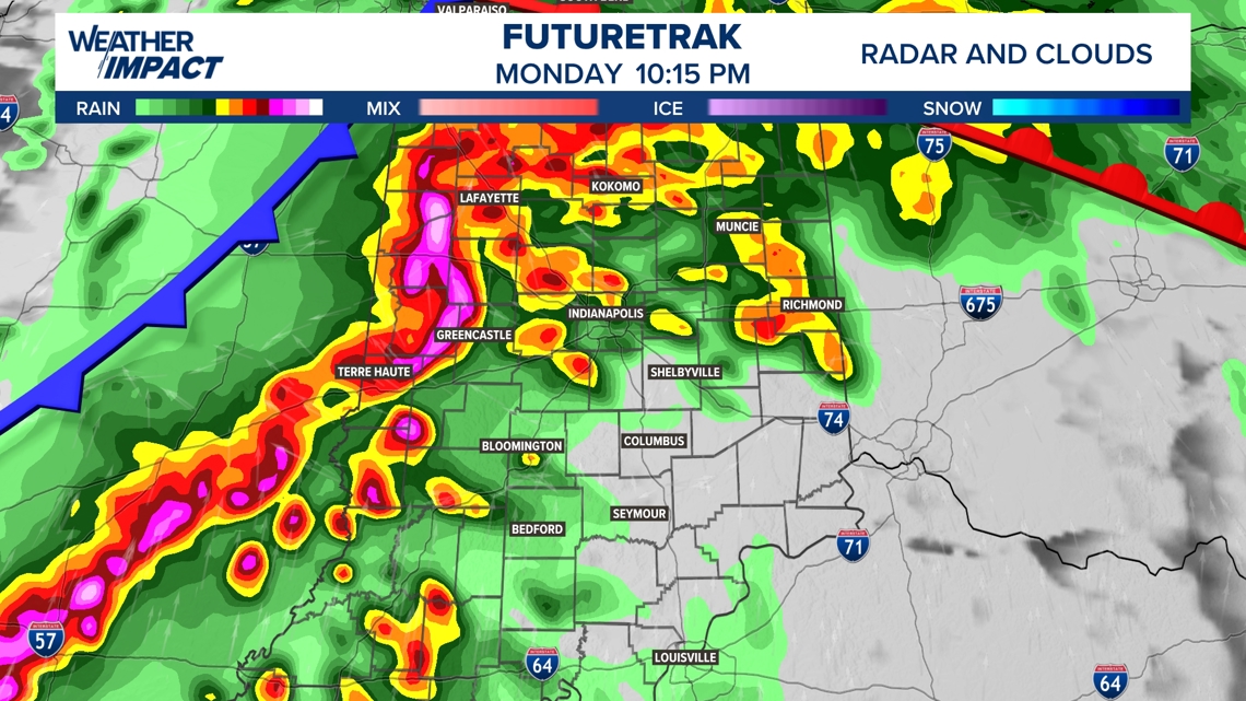
10:55 p.m. – A Tornado Warning was issued until 11:15 p.m. for southern Hendricks, northern Johnson, southern Marion and northeastern Morgan counties. A storm with radar-indicated rotation was located over Mooresville, moving east at 55 mph.
The National Weather Service says impacted locations include Indianapolis, Greenwood, Franklin, Beech Grove, Mooresville, Southport, New Whiteland, Whiteland, Brooklyn, Homecroft, Lake Hart, Waverly, and Camby.
10:24 p.m. – A severe thunderstorm warning is in effect until 11 p.m. Monday for Grant, Hamilton, Hancock, Marion and Miami counties.
10:18 p.m. – Trees and power lines are reported down near Purdue University in Lafayette due to severe thunderstorms that moved through the area Monday night.
10:07 p.m. – A Severe Thunderstorm Warning has been issued until 10:45 p.m. for Boone, Clinton, Hamilton, Hendricks, Howard, Madison, Marion and Tipton counties and Owen and Putnam counties until 11 p.m.
9:50 p.m. – A Tornado Warning has been extended until 10:15 p.m. for Boone, Clinton, Fountain, Montgomery and Tippecanoe counties.
A severe thunderstorm capable of producing a tornado was located 12 miles southwest of Frankfort around 9:45 p.m., moving east at 50 mph, according to the National Weather Service. The storm, which included radar-indicated rotation, is likely to impact Frankfort, Thorntown, Kirklin, Colfax, Clarks Hill and Michigantown. It will cross Interstate 65 between mile markers 145 and 162, southeast of Lafayette.
8 pm Update 4/27/2026
Windy but quiet from a radar perspective around Indy…for now. Heavy rain axis continues to cause flooding in south-central Indiana and areas of wind damage with some 5,000 customers without power in Jackson/Jennings counties combined. The atmosphere along the I-70 corridor remains stable near the surface at this time.
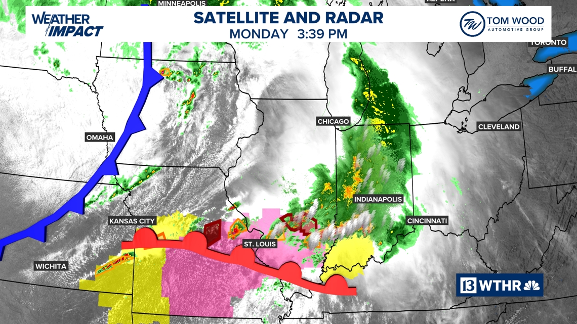
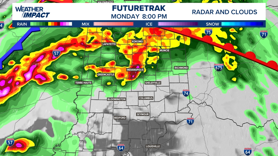
We’re monitoring a line of intense storms in a much more favorably sheared/unstable environment in Illinois that’s prompting wind and tornado warnings. It’s moving quickly toward Indiana…arriving now by 9 p.m. It remains uncertain how long it will remain severe.
But it will have a strengthening low-level wind field in advance of it to keep damaging wind/rotation potential in play western and central Indiana until it exits Indiana around 1 a.m. Angela will be on WTHR+ every half-hour and on Channel 13 if any Tornado/Destructive Thunderstorm Warnings are issued.
5:25 pm 4/27/2026
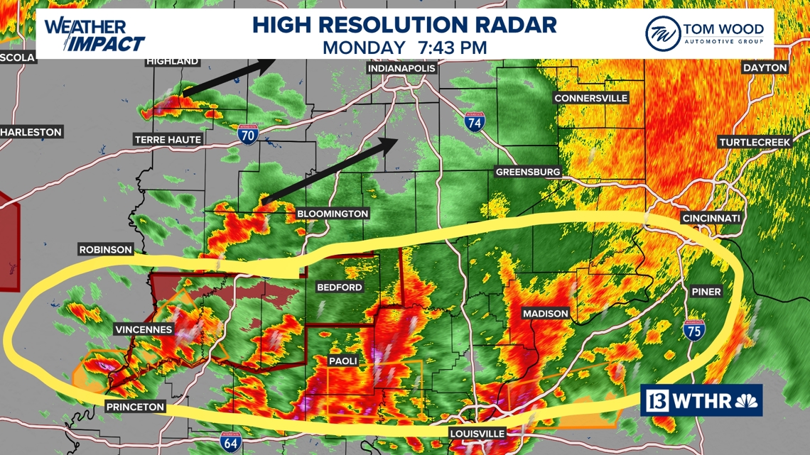
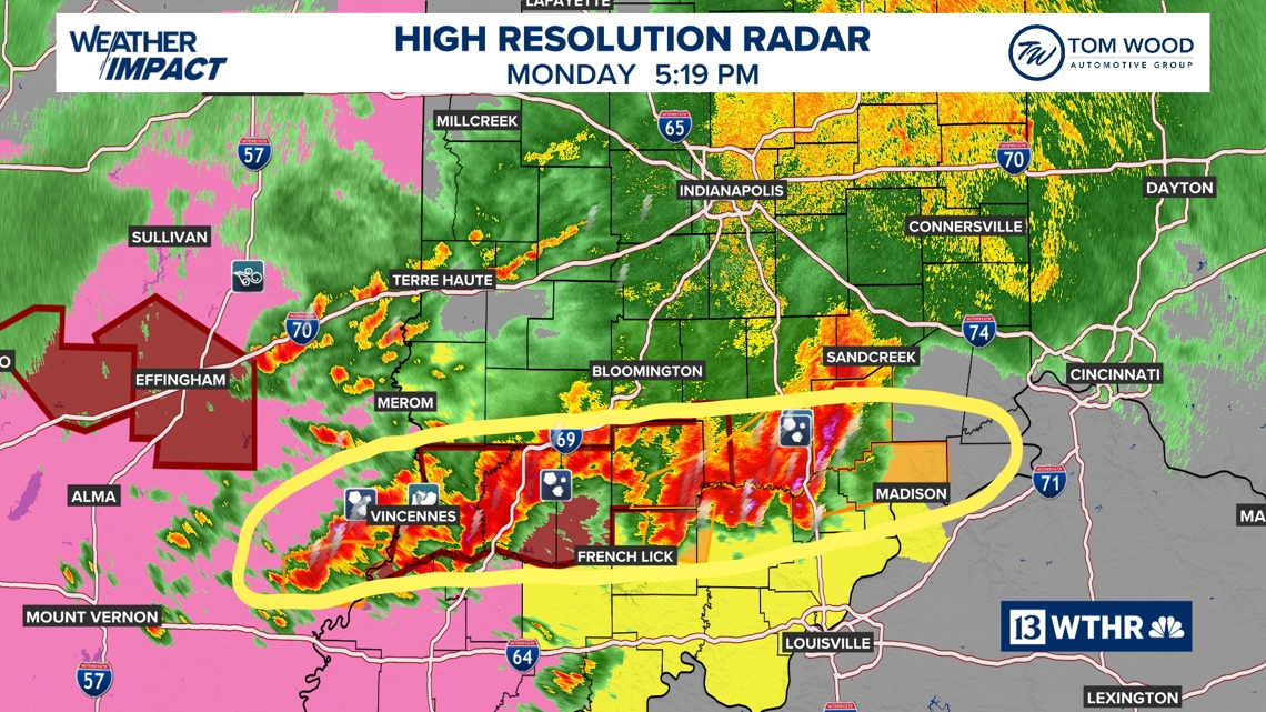
Severe storms continue in south-central Indiana where several reports of quarter-sized (and greater) hail have been reported and Flash Flood Warnings up from Vincennes, Logootee, and Bedford.
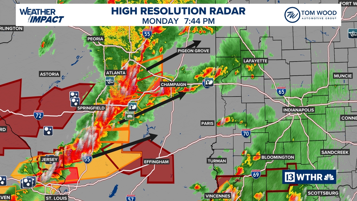
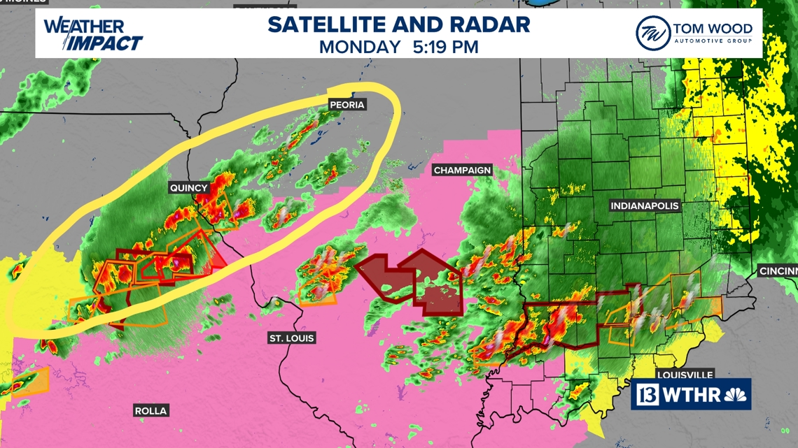
We’re watching an area of storms increasing over Missouri and west-central Illinois.
Though our local atmosphere has been worked over and instability is minimal north of the current storm axis… increasing low-level wind fields will allow storms to our west to intensify in the coming hours and bring a wind/tornado threat after 7 pm.
A new Tornado Watch is up to the Illinois/Indiana stateline until 10 pm. That Watch may be expanded into Indiana later.
Hi-res modeling suggests parameters will be strong enough to support some stronger tornadoes west of I-65 later this evening.
Remain Weather Aware and expect additional Watches/Warnings before midnight.
We’ll continue update.
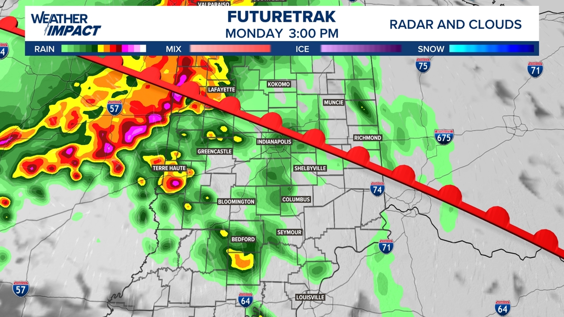
3:45 p.m. Monday, April 27 update
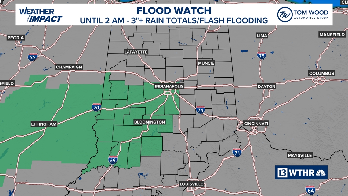
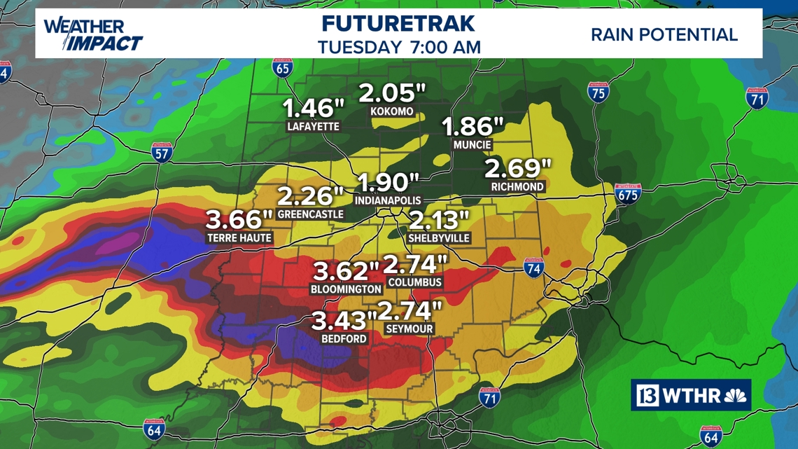
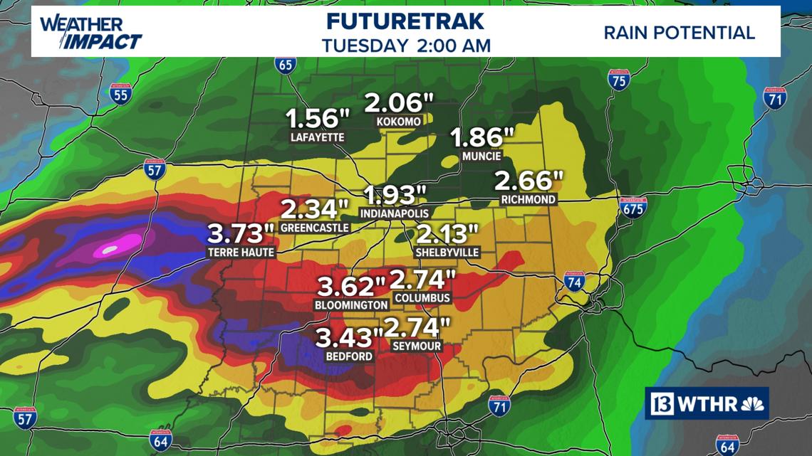
A flood watch has been issued for the southwestern half of the state, including Indianapolis, until 2 a.m. Additional heavy rain/storms could boost localized totals to 3-5 inches and create flash flooding.
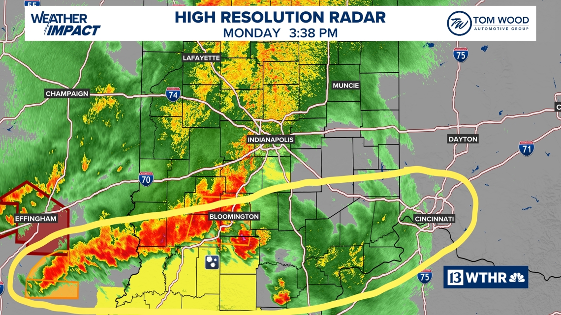
The main area of concern currently is south of I-70, where severe thunderstorm warnings continue on the southern flank of this storm complex from Linton-Bloomington-Columbus and points south.
We’ll wait and see how much atmospheric recovery can take place before the front farther west arrives later this evening.
The severe potential continues until around midnight.
We’ll have live coverage on WTHR Channel 13 between 4-7 p.m. and all evening on WTHR+.
1:25 p.m. Monday, April 27 update
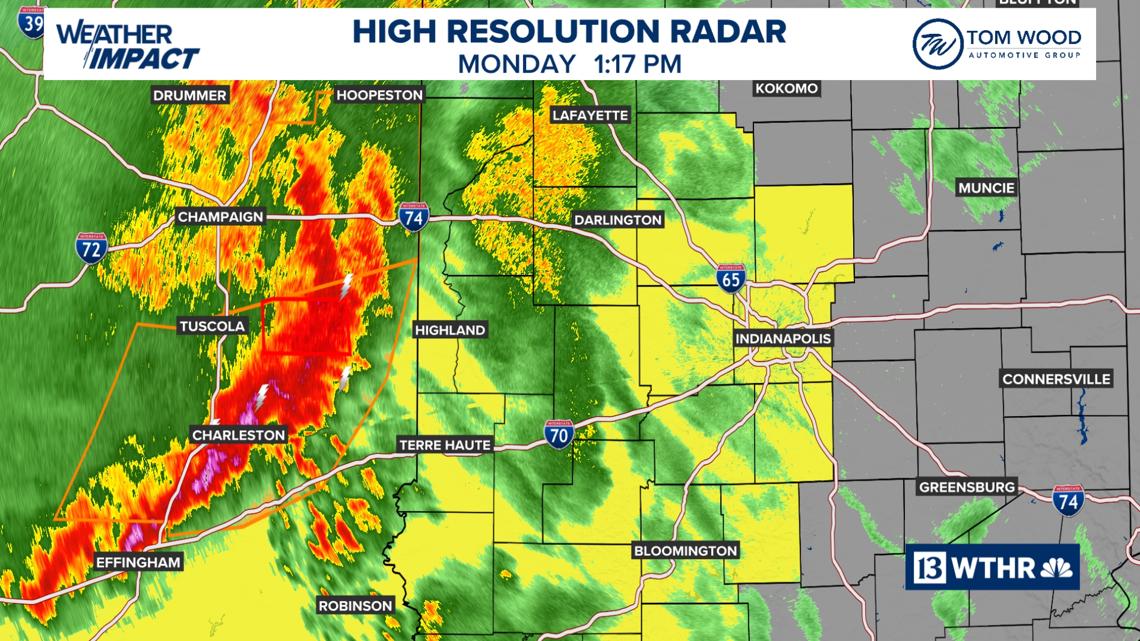
The storm line that’s prompted a combination of severe thunderstorm and tornado warnings in Illinois is near the Illinois/Indiana border.
The environment in front of it currently in Indiana is not as favorable for severe weather, but they may change later today. We’ll be watching closely. At minimum, it brings a round of rain and rumbles to impact the afternoon rush.
We do expect additional development to occur downstream and the likelihood of storms “training” near/south of the Interstate 70 corridor, upping the odds of flash flooding this evening. Localized areas of 3″+ rainfall are likely within the quickly moistening airmass.
The highest probability for severe wind/rotation/tornadoes remains near/south of I-70 and west of I-65.
It’s important to have ways to get any warnings that may be issued between now and midnight.
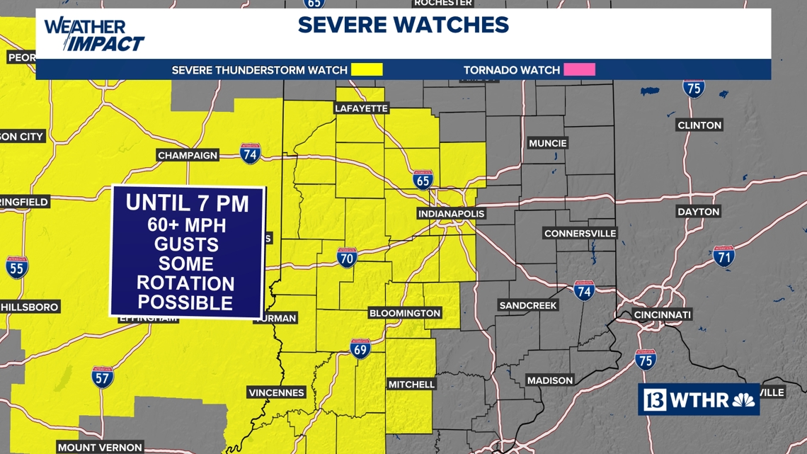
The current severe thunderstorm watch (yellow) goes until 7 pm. Additional watches/warnings are expected.
12:30 p.m. Monday, April 27 update
A severe thunderstorm watch is in effect until 7 p.m. for central/western Indiana.
A complex of storms in Illinois is holding its own and is heading this way. It’s had a history of some wind damage/rotation.
Plan on heavy storms impacting the afternoon commute and high impacts to after-school activities.
The environment locally isn’t as favorable right now, so we’ll see how much strength they maintain.
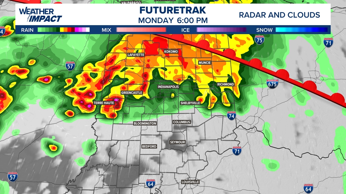
The storms are on the IL/IN line currently and will reach the Indy metro area between 3 p.m. and 4 p.m., and east of I-65 by 6 p.m.
Severe wind gusts and rotation are possible, in addition to flooding rain.
Rain/storms continue most of the evening along the I-70 corridor, but the focus for severe wind/rotation shifts to southwestern Indiana on the southern side of the storm line.
The threat of severe weather ends by 1 a.m.-2 a.m.
We’ll be on WTHR+ frequently this afternoon/evening and on Channel 13 if any tornado or destructive thunderstorm warnings are issued on our area.
Multiple waves of storms Monday
For this morning, a weakening wave of rain could bring a few stray showers as a warm front lifts through Indiana.
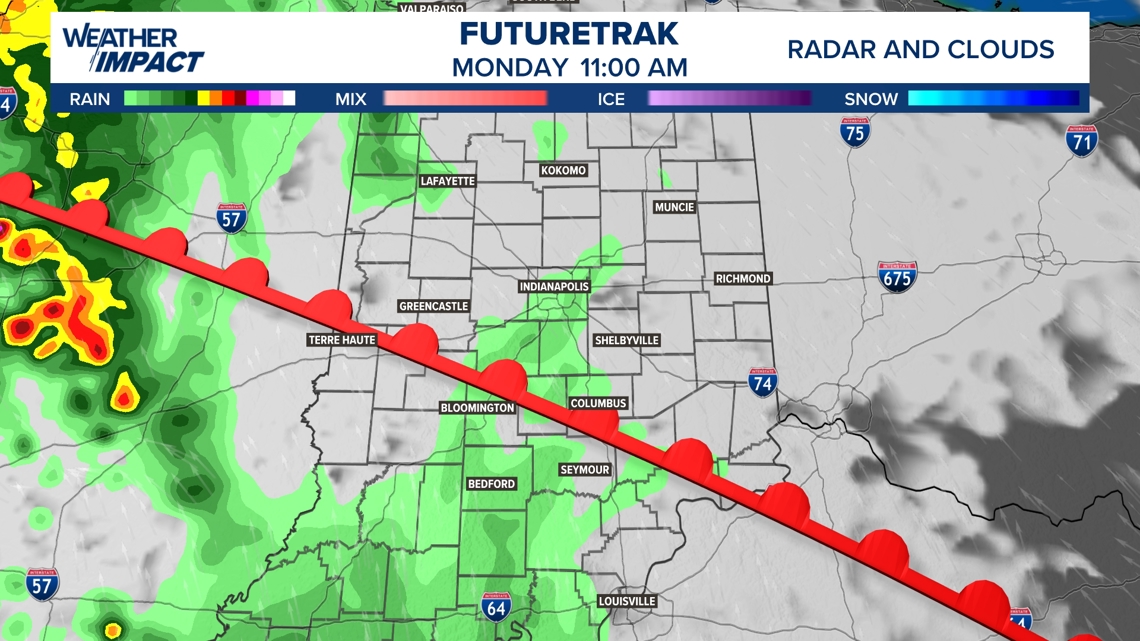
The Missouri complex of storms will arrive in the mid-afternoon, approximately around 3 p.m. This will be a low-end severe threat, but gusty winds, lightning/thunder and brief heavy rainfall could lead to localized flooding.
We’ll have to wait and see how this first round of storms impacts our atmosphere and the next round of storms that is set to arrive after sunset.
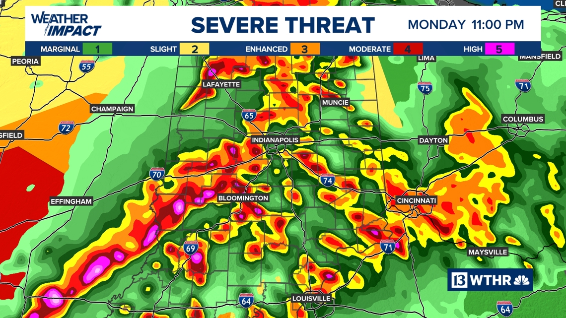
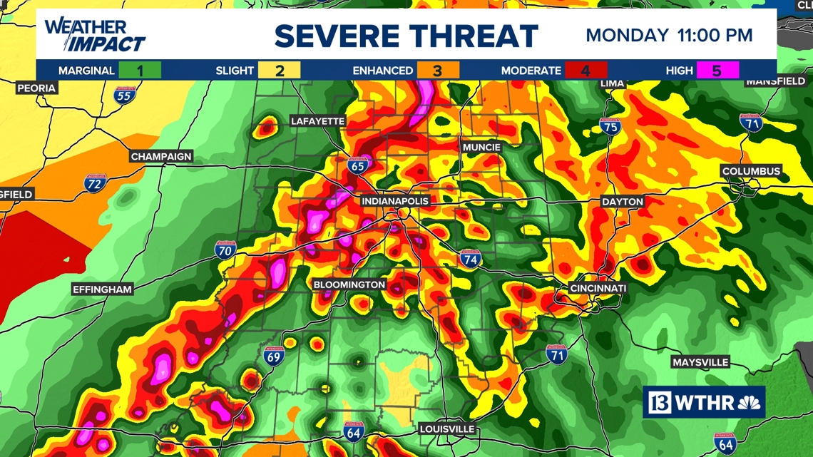
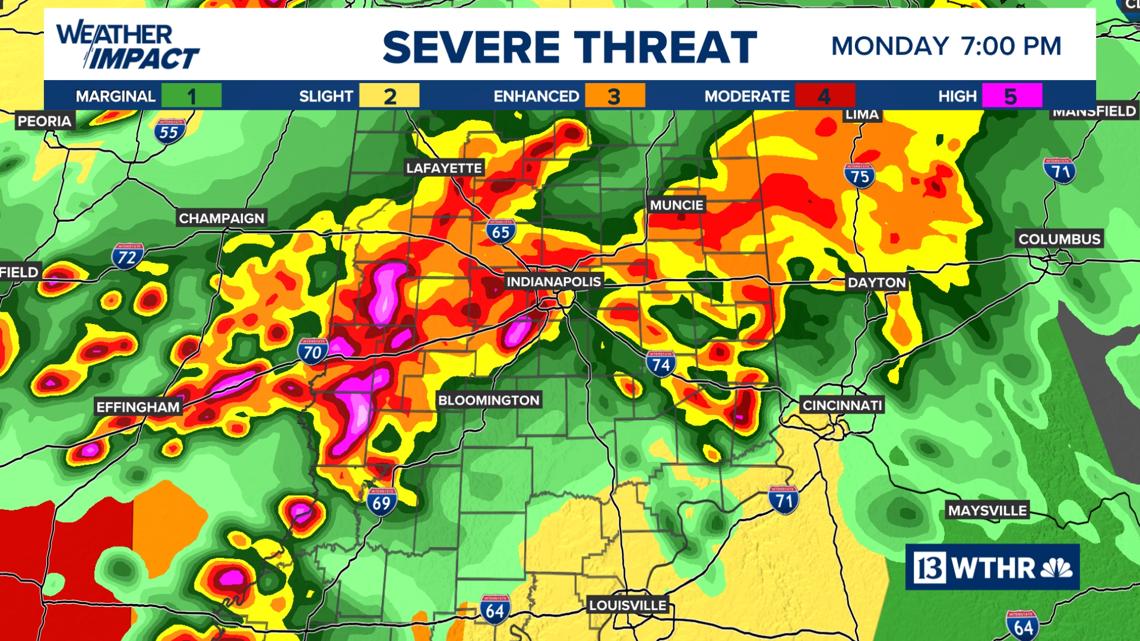
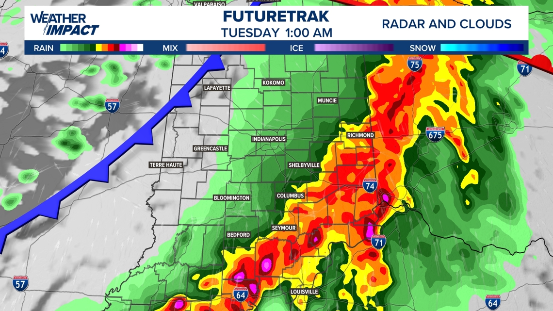
Severe storm risk timeline: Monday 8 p.m. – 2 a.m. Tuesday
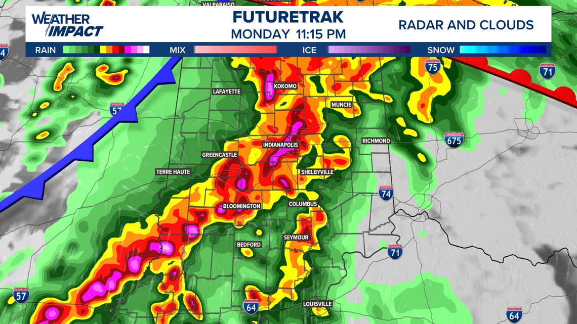
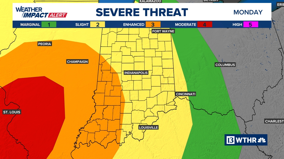
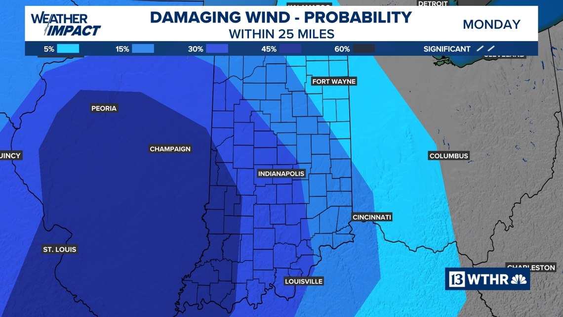
Severe storm risk forecast: The Storm Prediction Center has placed the western tier of Indiana under a Level 3 of 5 risk for scattered severe storms possible. For now, storms will likely weaken as they track east, so the rest of Indiana is currently under a Level 2 of 5 risk for a less widespread severe storm risk.
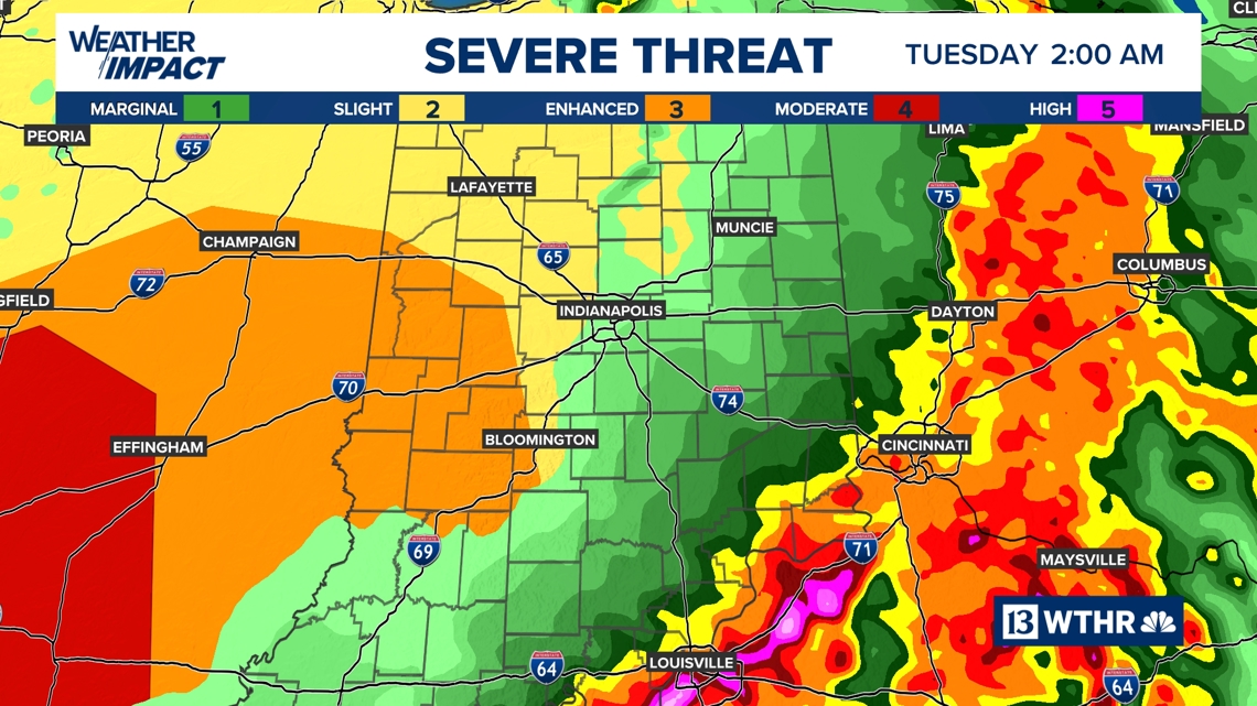
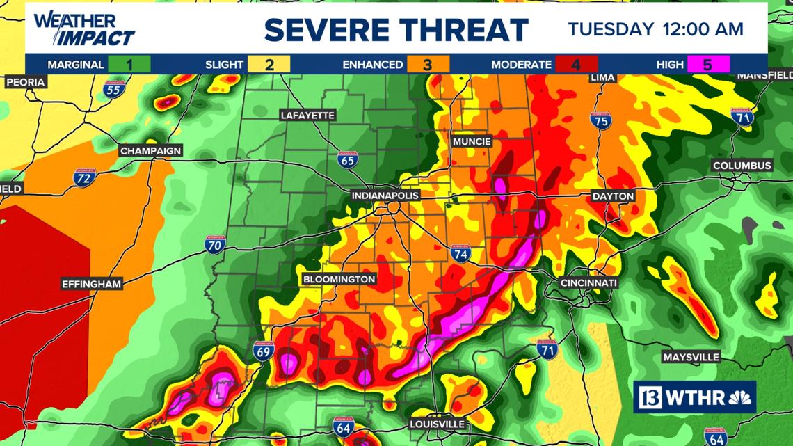
Primary threats: As storms initially develop in Illinois, all modes of severe weather will be possible, including tornadoes, large hail and severe wind gusts. As these storms are forecast to merge into a line as the system tracks east into Indiana, the primary threat will shift to mainly damaging wind gusts, but a few embedded rotating storms can’t be ruled out.
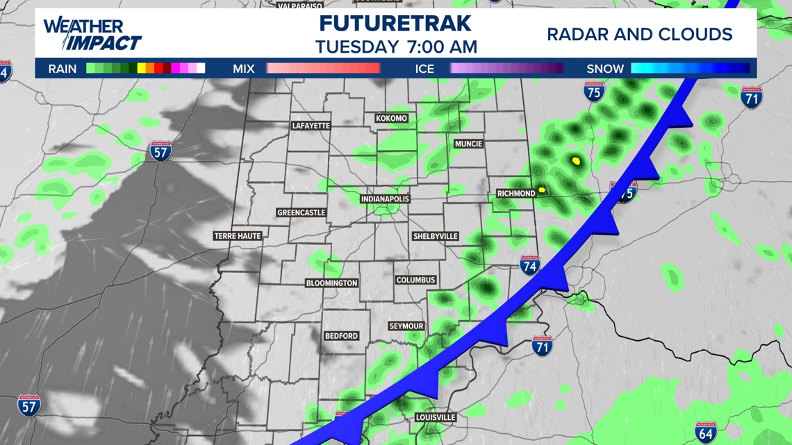
The line is forecast to weaken as it moves from west to east across Indiana and ends around 2 a.m. Tuesday. A few light showers will linger through Tuesday morning.
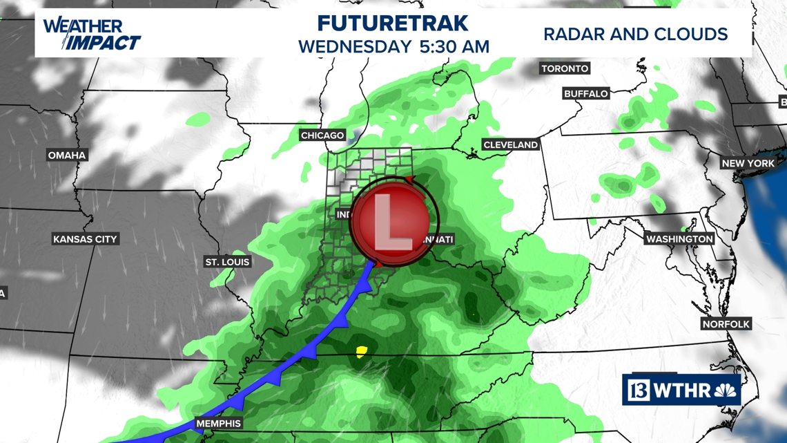
Cooler trend begins Wednesday
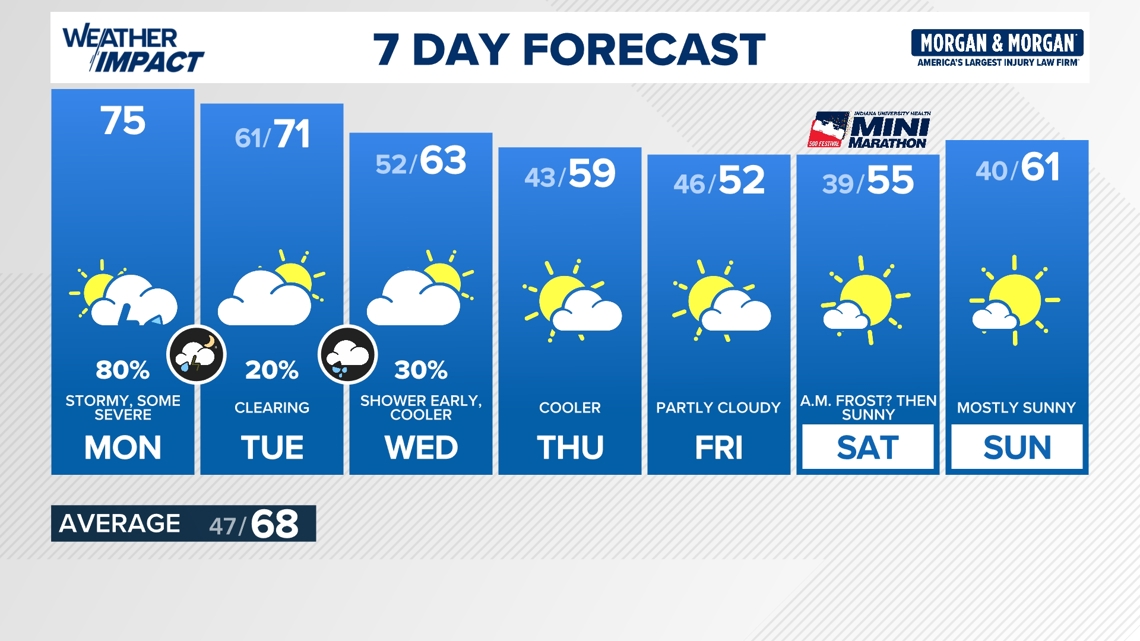
Another storm system is set to move through late Tuesday into early Wednesday morning, bringing another round of rain and isolated storms. The system will serve as a game-changer with our temperature trend. A cooler air mass will become more dominant over the region, dropping temperatures for Wednesday through the remainder of the extended forecast.
The chilly forecast remains in play for Mini-Marathon Saturday, with morning temperatures dropping as cool as the upper 30s and highs only in the upper 50s.
-13Weather Meteorologist Lindsey Monroe
